General
Life
Accessibility Options

General

General Products
Simple & Transparent! Policies that match all your insurance needs.


Scan to download

Life

Life Products
Digit Life is here! To help you save & secure your loved ones' future in the most simplified way.

Scan to download

Claims
Claims
We'll be there! Whenever and however you'll need us.
Scan to download
 General
 Life
Life
Renewals
Resources
Resources
All the more reasons to feel the Digit simplicity in your life!
Scan to download
Our WhatsApp number cannot be used for calls. This is a chat only number.


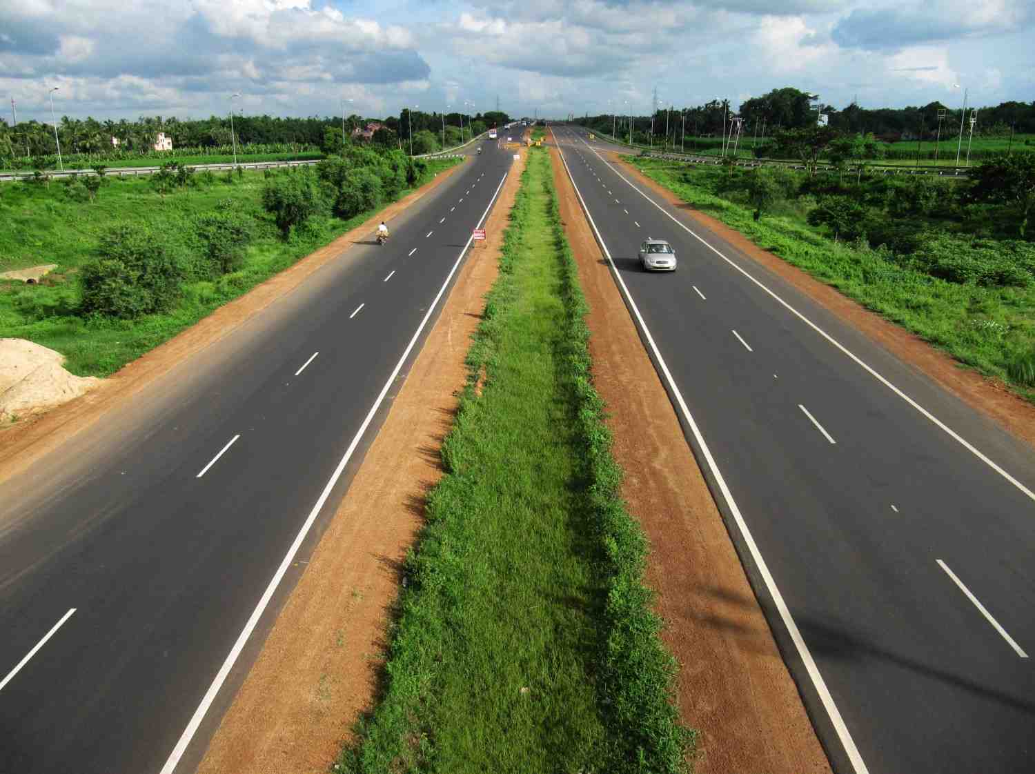
The Indian National Highways connect different states of India, offering mesmerising scenic beauty on the way. They play a crucial role in ensuring smooth connectivity between major cities across India by road. These highways help the Indian transportation system to run efficiently.
NH 52 is spread across some breathtakingly beautiful places and is known for its well-maintained infrastructure.
In this article, we will discuss interesting facts about National Highway 52.
The new numbering system of India assigns even numbers to the highways connecting north to south of India. NH 52 runs from north to south through the central parts of India, which explains its assigned number.
While travelling through this highway, you will cross six states. Let us learn about them and the routes in detail.
National Highway 52 is stretched across six major states. The routes of NH 52 cover:
Starting from the junction of NH 7 near Punjab’s Sangrur, National Highway 52 or NH 52 covers a long route up to Ankola in Karnataka. This highway is connected with old NH 13 near Bijapur. It is also connected to NH 66 (previously known as NH 17) near Ankola from where it goes towards the Arbail ghat.

National Highway 52 is 2317 km long and stretches from the regions of Punjab to Karnataka. This highway is spread across 6 different states. Here is a list showing the length division of NH 52 across the 6 states:
|
Name of the State |
Miles |
Kilometres |
|
Punjab |
34.18 |
55.00 |
|
Haryana |
88.98 |
143.20 |
|
Rajasthan |
439.06 |
706.60 |
|
Madhya Pradesh |
282.23 |
454.20 |
|
Maharashtra |
356.29 |
573.40 |
|
Karnataka |
120.14 |
193.35 |
*1.00 mile = 1.61 km
*1.00 km = 0.62 mile
This table explains how this highway mostly covers the regions of Rajasthan as it runs the longest through that state. On the other hand, even though it is starting from Punjab, it covers the lowest distance there.
Below are some of the types of vehicles which are allowed on National Highway 52:
These are the types of vehicles allowed on routes of National Highway fifty two. This applies to all vehicles using the highway.
Here are the speed limits based on vehicle categories:
Abiding these speed limits will help travellers avoid accidents on highways. Thus, it is important for them to follow the limit according to their vehicle type.
NH 52 runs through some of the most popular cities of India; thus, you can venture around and explore a few famous places while travelling. Here are some places where you can visit in each state:
Known as the “land of five rivers,” Punjab is a famous tourist spot known. You can find the following tourist places nearby to national highway 52:
Haryana is a place known for its historical landmarks and glamorous city life. While travelling through Haryana by NH 52 routes, you can explore the nightlife of Gurgaon or you can choose to visit some of these spots:
NH 52 covers the maximum distance through Rajasthan, and you can definitely explore the colourful cultural heritage of India in Rajasthan. Here are a few places you can stop by:
Madhya Pradesh is at the heart of India and is known for its grand wildlife sanctuaries and cultural aspects. Here are some places to see:
Maharashtra is another cultural gem of India known for its diversified beauty. You can find these famous places while travelling by the routes of NH 52:
National Highway 52 ends in Karnataka, and since the Western Ghats are situated here, you can enjoy the beauty of the mountains even in the southern part of India. Here are a few places to explore while travelling by NH 52 in Karnataka:
These were a few locations you can visit while travelling by the NH 52 routes. Now, let's move on to knowing some important things to remember while travelling on this highway.
If you are planning to travel via National Highway 52 for the first time, keep in mind these few things to travel without any hassle:
NH52 is an accident-prone route. So, do not overtake other vehicles while driving. Stay in your own lane to avoid accidents.
Try to drive when there is enough light; it is advisable not to travel on NH52 during the night because it can get significantly darker.
NH52 passes through several locations, so it is a congested route. Maintain a speed within the speed limit to avoid over-speeding. Be cautious when you see a sign warning about speed.
Consider getting comprehensive car insurance or bike insurance to protect against damage from accidents, natural disasters, and theft, along with roadside assistance for breakdowns in remote areas.
Having appropriate add-ons with commercial vehicle insurance also helps cover damage and liabilities specific to commercial use.
Driving through NH 52 can be a true pleasure if you are aware of these necessary rules and regulations. Keep in mind the speed limits and pay toll taxes at designated toll plazas to stay safe. This way, you can enjoy the journey and comfortably discover interesting places on the way. However, be aware of the possible risks of accidents and be cautious while driving.